Chongqing Hits 99.9% Warning Coverage with Digital Meteorological Platform
Chongqing - Inside the forecast center on the sixth floor of Chongqing Meteorological Station, screens displayed a detailed map of Chongqing with numerous real-time forecast data points.
Chongqing has been on high alert following the year's most severe rainfall from July 8 to 14. Influenced by a subtropical high-pressure system and a low vortex shear, the city experienced its second-strongest rainfall since 2008. During this period, the Chongqing Meteorological Bureau operated around the clock, focusing on flood control and disaster relief.
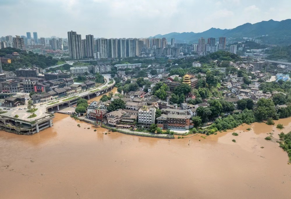
An aerial view of Ciqikou ancient town on July 12, during the flood peak's passage through Chongqing's central urban area. (Photo/Xie Zhiqiang)
Zhai Danhua, deputy director of Chongqing Meteorological Station, stated, "Our system forecasts precipitation every 2.5 kilometers, allowing precise rainfall analysis at each grid point." Chongqing has refined its grid forecasting to provide updates every 10 minutes to 3 hours, with a resolution of up to 1 kilometer.
The city's meteorological departments have adopted the "31620" service strategy, which includes a three-day special report, daily weather news, six-hour warnings, two-hour alerts, and immediate rain notifications. This strategy supports Chongqing's broader initiative to establish a digital weather system.
The Chongqing Meteorological Bureau developed four digital systems: the Tianshu Intelligent Detection System, the Tianzi Intelligent Forecasting System, the Zhitian Intelligent Service System, and the Yutian Intelligent Disaster Prevention System. These systems gather citywide radar data every minute and utilize a big data platform for rapid analysis and processing.

Tianshu Intelligent Detection System. (Graphic/Chongqing Meteorological Bureau)
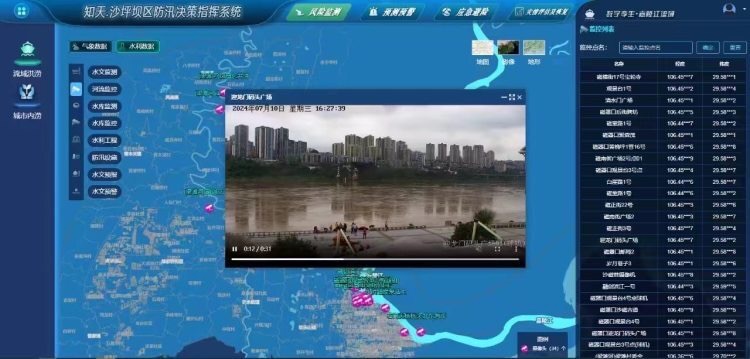
A live view of floodwaters flowing through the riverbank, captured by the Zhitian Intelligent Service System. (Graphic/Chongqing Meteorological Bureau)
The Yutian Intelligent Disaster Prevention System integrates disaster monitoring, collaborative analysis, warning dissemination, coordinated response, and data collection. He Shan from the Chongqing Early Warning Center highlighted its efficiency: "Using electronic fence technology, the system can quickly disseminate warnings, reaching 3,000 cell phones in one second and 44,000 within about 15 seconds."
"We also use icons in different colors to represent the status of the warnings-green for sent, yellow for seen, and red for unseen. This helps us quickly assess the response from various districts and counties," He added.
The Yutian system monitors disasters and compiles data from 60 monitoring categories, providing real-time geographic and departmental information. He explained, "It has tens of thousands of risk points with set alarm thresholds; when readings hit these thresholds, it automatically alerts emergency responders."
Moreover, the Yutian system efficiently disseminates warnings across multiple channels, achieving a 99.9% public coverage rate. It uses social media platforms like Douyin (China's TikTok) and Toutiao, a popular news platform, along with cable TV and various warning apps.
The Tianzi Intelligent Forecasting System, a key component of Chongqing's meteorological arsenal, accurately predicts weather conditions. It provides forecasts with resolutions as fine as 2.5 kilometers over 24 hours and 1 kilometer over 10 minutes.
"These forecasts are derived from global and mesoscale numerical models provided by the China Meteorological Administration, refined with AI algorithms for precise and detailed predictions," Zhai stated.

The foundational cloud platform for meteorology and big data. (Graphic/Chongqing Meteorological Bureau)
"Technologically, we've incorporated a decade's worth of three-dimensional radar, hail, and gale data to develop an AI-driven strong convection warning system. This technology assists forecasters in generating weather alerts for the next two hours," Zhai added.
 Related Stories