AI-Enhanced Remote Sensing Improves Flood Monitoring in Chongqing
Chongqing - On March 13, Chongqing's Key Laboratory of Remote Sensing Application and Innovation was officially launched in the Science City, Chongqing.
Gu Xingfa, an academician of the International Academy of Astronautics and president of the Chinese National Committee for Remote Sensing, highlighted that Chongqing's unique landscape and diverse climate provide great potential for innovation in remote sensing technology.
Perched in the upper reaches of the Yangtze River, Chongqing is vital to ecological protection and the New International Land-Sea Trade Corridor (ILSTC). Its blend of urban and rural spaces, mountainous terrain, and extensive reservoir zones makes it well-suited for remote sensing technologies, especially in disaster monitoring and environmental management.
The area's frequent floods, geological risks, and complex landscape underscore the pressing need for advanced meteorological services.
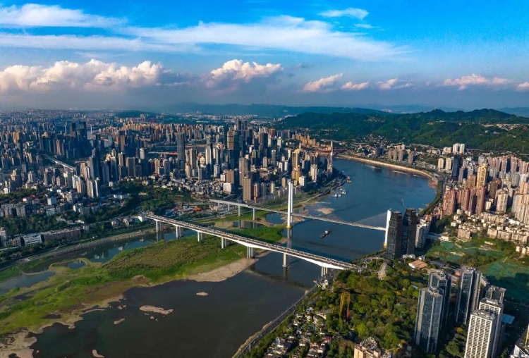
Part of the landscape of Chongqing. (Photo/Zheng Yu)
Gu stressed that these unique characteristics position Chongqing as an ideal hub for remote sensing research and its application in tackling pressing urban and environmental challenges.
The new laboratory, the third of its kind in the city, follows the establishment of the China Meteorological Administration's Laboratory for Climate Resource Economic Transformation and the Laboratory for Key Technology Research on Numerical Precipitation Forecasting and Artificial Intelligence Integration.
Located in Western (Chongqing) Science City, the lab will tackle key technological challenges, including intelligent processing and application of satellite remote sensing data, and remote sensing disaster monitoring and risk assessment, especially related to geological disasters, floods, droughts, and forest fires.
Additionally, the lab will support vegetation quality assessments and provide early warnings for ecological disasters, contributing to the protection and restoration of ecosystems in Chongqing and beyond.
Zhou Yuyu, Director of the Key Laboratory of Remote Sensing Application and Innovation, noted that Chongqing’s rugged terrain and frequent cloud cover often hinder continuous satellite observation.
To address these challenges, the laboratory is leveraging AI to integrate remote sensing data, improving precision and expanding spatiotemporal coverage. This technological advancement enhances flood monitoring accuracy during the summer while mitigating issues caused by shadows and obstructions in urban areas.
"Chongqing's mountainous urban areas present significant challenges for remote sensing, but we are confident that the integration of AI will push the boundaries of what's possible, delivering more accurate and timely data for flood monitoring and other disaster assessments," Zhou stated.
Recent breakthroughs by the Chongqing Meteorological Bureau in satellite remote sensing data processing, quality control, and spatiotemporal fusion have laid a strong foundation for the laboratory’s mission. Digital meteorological services have become a vital part of Digital Chongqing, supporting modern governance and strengthening the city's ability to address urban challenges.
Moving forward, the laboratory is committed to fostering international collaboration, particularly within the Belt and Road Initiative framework. By exploring cutting-edge technological advancements and contributing to global meteorological efforts, the lab aims to provide a "Chongqing Solution" that balances human development with environmental sustainability.
(Huan Ran, as an intern, also contributed to the report)
 Related Stories